
What a lovely day today has been! Like summer!:-)
As you can see from the Dysart clock above (did you know it was built in 1576!) I left Dysart at around 9:30am. The sun was already shining and it was warm. The walk from Dysart to West Wemyss is quite hilly with a few sets of steep stairs both upwards and downwards so I was even warmer by the time I got there.
Here are some of the lovely things I saw along the way:


West Wemyss is a really lovely village with a pretty harbour (not as pretty when the tides out I must admit) well-used by the locals; many ancient buildings that look like small castles and amazing overhanging rock formations that look like they are about to slide down on top of you:


That last house above (the white one above the rock formation) is weird. Its empty so all the windows have been painted in! Its just black paint with white paint for the frames. It’s a bit spooky:-)
I thought this sign was quite funny in West Wemyss:

I hadn’t been to East Wemyss before and didn’t think there was much there but was quite surprised at how nice it was too.
There was…

…the scrap yard:-) This was the first thing I saw so didn’t hold up much hope for it but it got better.
New houses along the front,
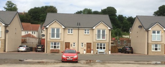
and old houses that were even nicer (this ones for sale by the way):
and Budda houses!

There were memorials neatly laid out for people who are no longer with us:


There were ancient caves,


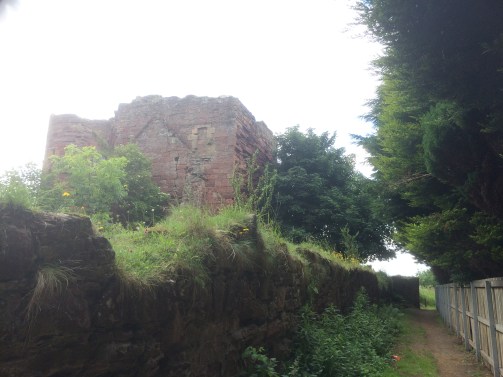
and a ruined castle (Macduff Castle I believe):
It was quite a steep climb out of East Wemyss then you get to the sign that says ‘Path to Buckhaven.’ Make sure you take the gravel path that leads to this lovely woody path – don’t go onto the main road (and no I didn’t before you ask:-) ).


But unfortunately I did go a bit wrong when I got to Buckhaven:-) After mile 42 I was supposed to turn right somewhere to get back down to the coast but must have missed it and stayed on the main road therefore I missed Methil and continued straight onto Leven – sorry Methil, nothing personal, I was probably texting or something:-) I was soon back on the path again once I reached Bawbee Bridge ( I was singing that song all afternoon about a child sitting on their mums knee wanting a ‘wee bawbee’ to buy some coulters candy – remember? Anyone? No, just me then:-) )
Things I saw in Buckhaven ( didn’t take many photos, I think I was trying to work out where I was:-) ).
Buckhaven Bay, past and present:


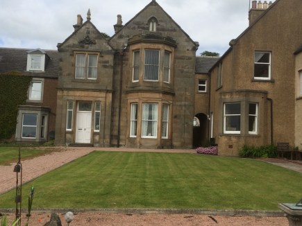
A nice church and a very old hospital:


And doesn’t this mess with your head:-)

Anyone lost a cucumber?:-)

Sorry, back to the Fife Coastal Path.
By the time I got to Leven I was roasting hot, hungry, thirsty and bursting for the loo so I just went into the first café I could find (I think it was Stuarts Bakers) so no tips on eating in Leven really just that there are loads of places so you wont be short.
Leven has a massive beach that leads on to Lower Largo and Largo Bay so after lunch it was a case of walking along the beach for miles – even I couldn’t get lost there:-) It was really lovely!


Lower Largo:


Lower Largo is apparently famous as the birthplace of Alexander Selkirk who was the inspiration behind Robinson Crusoe. There is a statue above the door of the house I assume where he was born:

After the detour through the streets of Lower Largo the path takes you back down to the beach again (there are public toilets there if necessary:-) ). The beach seemed to go on forever!


But I was on a mission. My family were doing the Elie Chain Walk so I wanted to meet them afterwards for a coffee. I knew from Lower Largo it was another 6/7 miles to Elie so I still had a lot of walking to do. Eventually, I got to the end of Largo Bay to discover the tide had come in and blocked me in with it. I had to go back the way I came over the sand dunes across a couple of bridges just to get back to where I was – so watch out for the tides!


Once I navigated round the dunes then the path took me around a caravan sight and up over the cliffs. Its quite a long and strenuous walk (six miles uphill then steep downhill again with narrow paths and long grasses). But lovely views:-)


And after a bit of a hike around a golf course and through Earlsferry look who I found in The Ship Inn:


We had a lovely coffee in here as all the other cafes were closing (it was only 5pm!)including my ice cream shop!

After a well earned rest and a good catch-up the family had to rush off to take Carys to gymnastics but I knew I only had 2-3 miles left to get to St. Monans where my 21 mile walk was finishing for today. And what a lovely to finish! Walking round the coast from Elie to St Monans is simply amazing!


And some first glimpses of St.Monans (church and harbour)


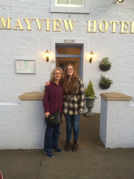
To top an already perfect day my friend Mary and her daughter came to meet me on the last mile or so of today’s trek and treated me to tea! Thank you Mary!
And now I’m writing this blog in my lovely B&B Grannies Harbour. Look at my view:


Its been another great day walking the Fife Coastal Path. Roll on tomorrow!
